http://vimeo.com/75260457
Really cool video!
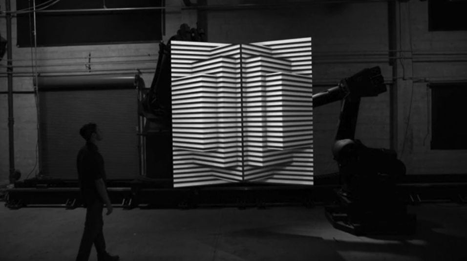
via This astounding video just took projection-mapping to the next level.
http://vimeo.com/75260457
Really cool video!
via This astounding video just took projection-mapping to the next level.


A really amazing Minimum Wage Machine. Turn the crank for an hour and you'll get paid NY's minimum wage in coins. (one penny every 4.97 seconds, for $7.25)
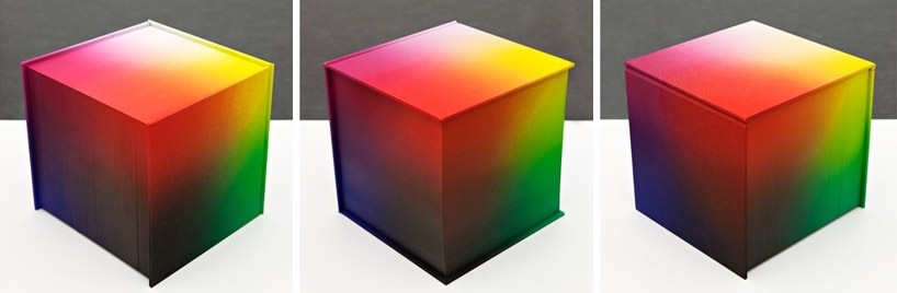
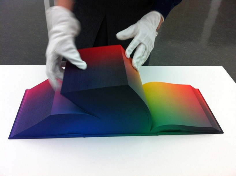
I absolutely love the concept of this printed color-spectrum book. its neat to think of color 3 dimensionally and e able to physically pull a page out of a certain plain to dissect it. WOW.


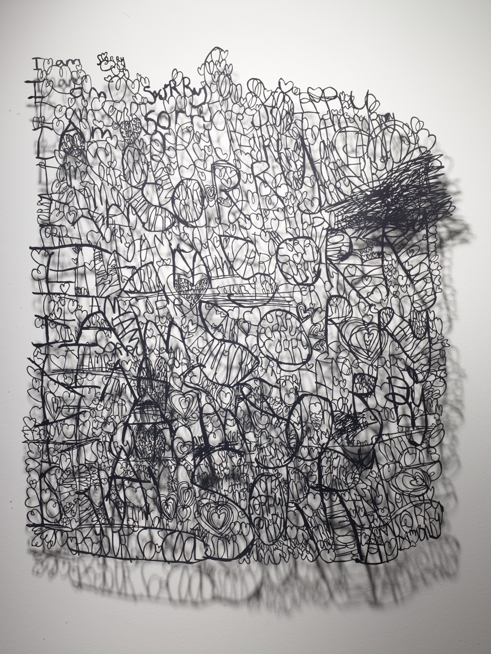
The detail of the hand-cut works from Annie Vought is stunning.


This. is. beautiful.

http://www.theeaglemanstag.com/WATCH-THIS-FILM
by Mikey Please.
// hat tip James


I've posted about Hollis Brown Thornton before, and I'm pleased to announce that 20x200 just released a new print! The print is titled "When We Were Kings" and it is ultra rad. Love his style.

check it out on 20x200.
who knew that he also did the cover of a great album.. Sleigh Bells "treats"

as always: check the website... http://www.hollisbrownthornton.com/
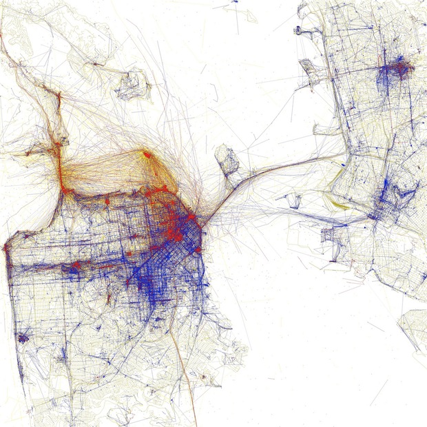
Fast Company has a wonderful article about how photographer Eric Fischer uses Flickr geotags to map world cities. Using Flickr's public API he's created over 50 elegant city maps. These are just facinating and beautiful! A great representation of community, humanity, and the art of open source.
Fast Company explains the color coding as:
Black is walking (less than 7mph), Red is bicycling or equivalent speed (less than 19mph), Blue is motor vehicles on normal roads (less than 43mph); Green is freeways or rapid transit.
Here is San Francisco:

New York:

London:

Eric also made a set based upon weather you are a tourist or a local. Here is what he had to say about it on his Flickr:
Blue points on the map are pictures taken by locals (people who have taken pictures in this city dated over a range of a month or more).
Red points are pictures taken by tourists (people who seem to be a local of a different city and who took pictures in this city for less than a month).
Here is New York Based upon Tourists or Locals:

And San Francisco based upon Tourist or Local: (I love how Alcatraz and the Golden Gate, and the Pier are clearly defined as tourist)

Check out the Fast Company article, Eric's Fischer's Local's and Tourist's Flickr Set, and his Geotaggers' Word Atlas Flickr Set.
Christiana Couceiro is a freelance illustrator, working and living in Lisbon, Portugal. Her collages are really inspiring... very mid-century. And I just love her art series on her website. Check it out!


found via ISO50
Sara Cannon is a Web Design and Branding Specialist | Helping brands build seamless digital experiences.
She's also an Artist.
Do you have a project she can help you with? Contact Sara at sara@saracannon.com.


